-40%
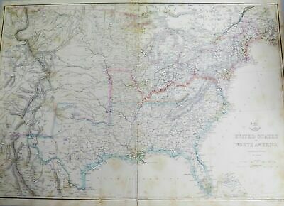
.1860s CIVIL WAR ERA LARGE MAP EASTERN & CENTRAL UNITED STATES. WEEKLY DISPATCH.
$ 57.86
- Description
- Size Guide
Description
1860s CIVIL WAR ERA LARGE MAP EASTERN & CENTRAL UNITED STATES. WEEKLY DISPATCH.This is a 2 page taped together double page map. Total combined measurement is approx 46cms x 64cms. Foxing and marks as per photos, small tears to the margins. Looks better than the photo
’s depict. The rear is
blank, lightly hinged to cardboard backing.
Will be posted flat.
Always happy to combine postage where possible & practical. HNCO are not responsible for import duties or customs charges. This is the buyers /
importers responsibility.
_gsrx_vers_854 (GS 7.0.18 (854))


